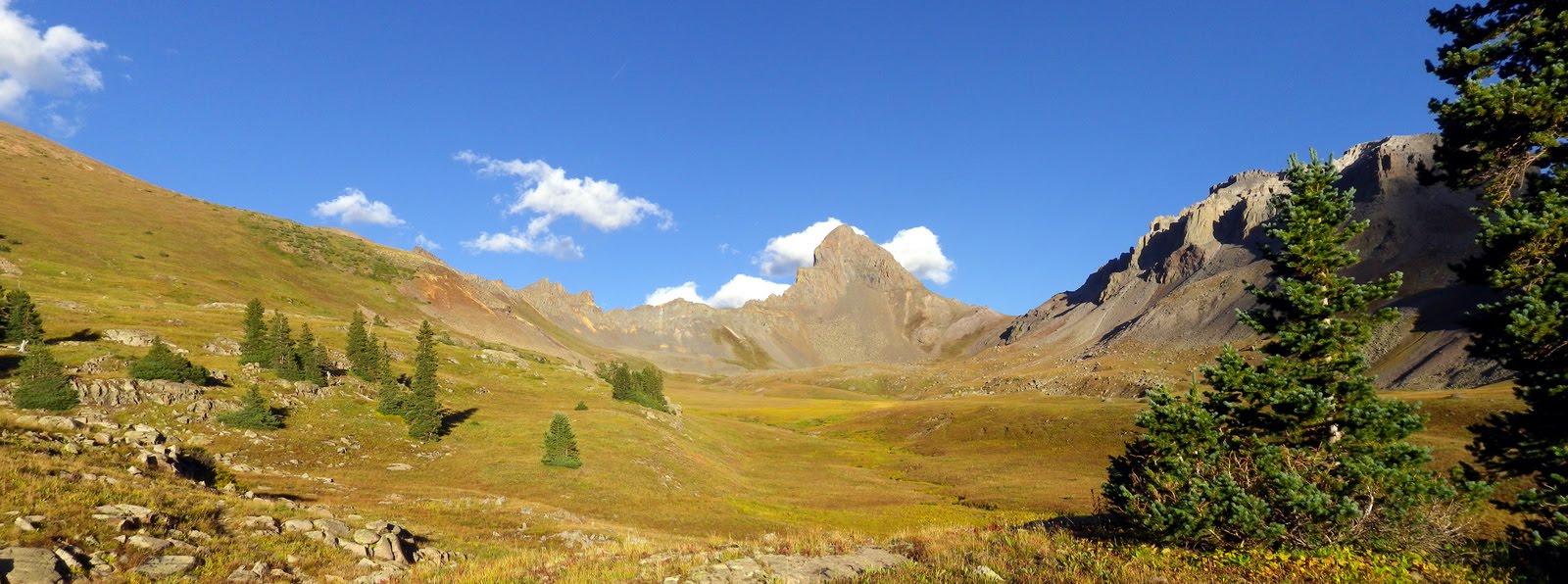
Wetterhorn Peak from our camp in Wetterhorn Basin
Date: September 5-6, 2010
Distance: ~15 miles total
Vertical: ~4700 feet
Time: 3.5 hours from camp to summit and back to camp
Peaks: Wetterhorn Peak (14,015 feet)
Route: West Cimarron Pass to Wetterhorn Basin. Southeast Ridge from Wetterhorn Pass.
[This is Part 3 of our Labor Day weekend 14er blitz in the San Juans. The rest of the reports are found here: Part 1 - Part 2.]
Originally we planned on climbing Wetterhorn and Uncompahgre Peaks on the last day of the trip, but ended up deciding on just Wetterhorn. This was primarily due to the fact that once we finished hiking, we still had a long drive back to SLC. Also, rather than using the standard Matterhorn Creek approach from the south, we really had our hearts set on taking the more scenic (in my opinion) and MUCH less used West Cimarron Pass / Wetterhorn Basin approach from the west. So, after getting off the train in Silverton, it was on to Ouray, where we stopped for ice cream, and then up and over Owl Creek Pass to the Wetterhorn Basin trailhead. We packed up our bags and hiked 3.5 miles and 1700 feet up to West Cimarron Pass (12,500 feet), then dropped about 1.5 miles into Wetterhorn Basin (~11,700 feet). The views of Wetterhorn, the alpenglow, and the sunset from our camp site were INCREDIBLE! It was also cold at that elevation, so a hot bowl of chili for dinner hit the spot perfectly.
We didn't sleep much that night due to persistent high winds and rain, but we awoke to clear skies and dry ground. It was on! At 6:30am we hit the trail. There isn't much of a trail once you get beyond the stream crossings in Wetterhorn Basin; you more or less orient yourself towards Wetterhorn Pass and head towards it. Once on top, you just try to keep as much elevation as possible while contouring to the SE ridge. From there it was quick going... mainly a class 2 trail with some fun class 3 scrambling at the end. We reached the summit at 8:15am. Our descent was even quicker (round trip was 3 hours). West Cimarron Pass needed to be re-climbed on the pack out, but that was easy going from the Wetterhorn side (only ~700 feet up), and we were back at the trailhead and on the road to SLC by noon. It was an amazing trip!!! Thanks Andrea for climbing all these peaks with me!!!
I've now been on top of 48 of the 58 14,000 foot peaks in Colorado. At some point I'll probably finish, but its definitely not a priority at this point because there are so many other places I want to visit and mountains I want to climb. Some of the 14ers I have left (ie. San Luis, Pikes) are just not that exciting. I hope the next trip to CO will include peaks such as Arrow, Vestal, the Trinitys, and routes such as the Grand Traverse (near Vail) and Tenmile traverse (Breckenridge). And considering how close we are to the Tetons and Wind Rivers, that's probably where we'll end up spending a lot more time next summer and fall.

Driving on the million dollar highway (US-550)

Ouray, CO

Start of the West Fork Trail

Pack/Back break on the way up the pass

Top of the pass

First look at Wetterhorn... awe-inspiring!

Our campsite at 11,700ft

Wetterhorn in the evening

Sunset

Wetterhorn's much less intimidating SE ridge

Andrea scrambling up the final class 3 pitch to the top

Wetterhorn summit

Summit views

Coxcomb and Redcliff

You can (barely) see our campsite down in the basin

Heading down

The Wetterhorn to Matterhorn ridge

Looking North from our camp back towards the West Fork Pass

Looking west in Wetterhorn basin

Looking north from the top of West Cimarron Pass

Precipice Peak

Chimney Rock


No comments:
Post a Comment